Last Updated 2 hours ago by Kenya Engineer
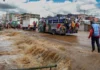
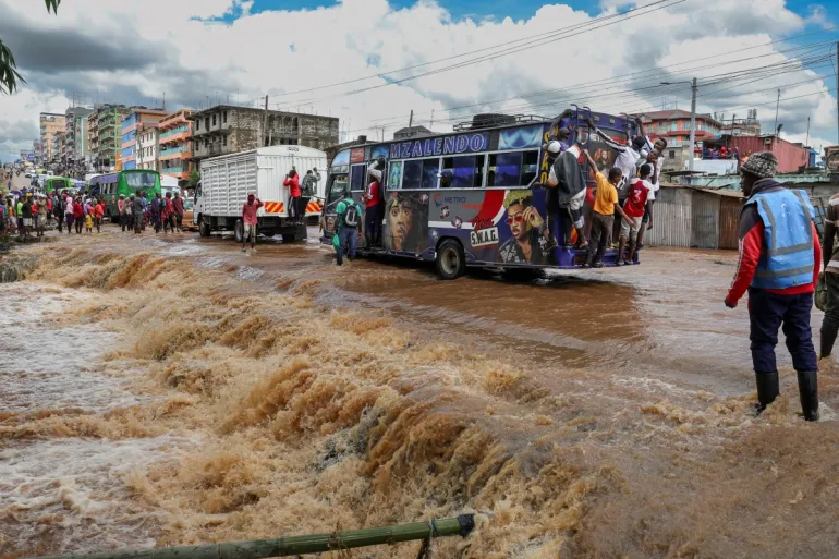
When heavy rain falls over Nairobi, the consequences can be immediate. Roads become impassable, vehicles are swept into flooded channels, homes and businesses are inundated, and residents in low-lying neighbourhoods face the danger of drowning, electrocution and contaminated water.
The recurring nature of these events raises an important engineering question: why does a city with established drainage networks, rivers, road infrastructure and a substantial body of engineering expertise continue to experience destructive flooding?
Rainfall is part of the explanation, but it does not tell the whole story. Nairobi’s flood risk is shaped by how the city has developed, how its drainage systems function and how effectively natural waterways and engineered infrastructure are managed.
A July 2026 assessment by the World Resources Institute identified a combination of extreme rainfall, settlement in flood-prone areas, inadequate drainage, degraded wetlands, loss of green space and fragmented institutional responsibility as factors contributing to Nairobi’s vulnerability. Its research also highlighted the disproportionate impact on residents of informal settlements located along river corridors and in low-lying areas.
A city whose drainage system is under pressure
Urban development changes the way rainfall moves across a catchment. Vegetated land and other permeable surfaces allow some rainwater to infiltrate the ground or be temporarily stored. Roofs, roads, parking areas and paved compounds reduce infiltration and increase the volume of water that runs off during a storm.
As development intensifies, water can reach drains and rivers more quickly. The resulting peak flow may exceed the capacity of culverts, roadside drains, bridges and river channels, even when the total rainfall is not unprecedented.
This problem becomes more severe when drainage infrastructure has not kept pace with development. A drain designed for an earlier pattern of land use may be inadequate for a densely built-up catchment. Blockages caused by solid waste, sediment and vegetation can further reduce its effective capacity.
Maintenance is as important as construction. A drainage network cannot perform according to its design if its inlets are blocked, culverts are silted up or downstream channels are obstructed.
The solution is not to assume that every drain needs to be enlarged. Engineers must first establish where the system is failing, how much runoff it must carry, where the water is coming from and whether increasing capacity in one location would transfer the flooding problem downstream.
Rivers, wetlands and the space water needs
Nairobi’s natural drainage system is an essential part of its flood infrastructure. Rivers and their floodplains provide routes through which stormwater moves across the city. Wetlands and vegetated areas can store water temporarily, slow runoff and support infiltration.
Encroachment into riparian corridors reduces the space available for rivers to convey high flows. Construction within floodplains places buildings, roads and utilities directly in the path of water. Replacing open land with impermeable surfaces also increases runoff from the wider catchment.
River restoration must therefore be treated as an engineering and land-use intervention, rather than an isolated environmental programme. It requires catchment mapping, flood modelling, protection of riparian reserves, improved wastewater management and appropriate treatment of areas where people already live.
Where households face unacceptable flood risk, relocation may be necessary. However, resettlement should follow transparent risk assessments, meaningful consultation, fair treatment and practical arrangements for housing, livelihoods and access to services. Moving residents without addressing the underlying land and drainage problems can merely transfer vulnerability elsewhere.
Engineering solutions must work together
Nairobi needs an integrated flood-management programme that combines conventional drainage with measures that retain, slow and safely convey stormwater.
First, county and national agencies should establish an updated inventory of drains, culverts, bridges, rivers and flood-prone locations. Hydraulic assessments should identify bottlenecks and compare the capacity of existing infrastructure with rainfall scenarios appropriate to the level of risk.
Second, routine maintenance should be supported by scheduled inspections, desilting, waste removal and rapid reporting of blocked drainage structures. Before the rainy seasons, priority should be given to known flood hotspots and critical transport routes.
Third, new development should be assessed against the capacity of the receiving drainage network. Detention ponds, retention basins, rain gardens, permeable paving, green spaces and rooftop rainwater storage can help reduce or delay runoff where site conditions permit. These measures complement, rather than replace, properly designed drains and flood channels.
Fourth, river corridors and wetlands must be incorporated into urban planning. Flood modelling should guide decisions on bridge openings, channel improvements, road levels, embankments and areas where development should be restricted. Poorly designed flood barriers can worsen conditions elsewhere, so interventions must be assessed at catchment scale.
Finally, Nairobi needs stronger coordination among agencies responsible for roads, drainage, water and sanitation, land-use planning, environmental protection and disaster response. Floodwater does not follow administrative boundaries, and an intervention that works for one department may fail if another department’s infrastructure remains inadequate.
Protecting lives when floods arrive
Long-term infrastructure investment will take time. Public safety measures must therefore be treated as part of flood management, not an afterthought.
Residents should monitor official weather alerts and emergency instructions, identify safer routes and evacuation points, and avoid travelling through areas known to flood during intense rainfall. Floodwater can conceal open drains, damaged road surfaces, deep channels and other hazards.
Never attempt to walk, swim or drive through moving floodwater. Even water that appears shallow can sweep a person off their feet, while a vehicle may lose traction or float. If water is rising around a vehicle, occupants should leave only when they can reach a safer location without entering dangerous moving water. Otherwise, they should contact emergency services and follow rescue instructions.
Electricity presents another serious danger. Floodwater can contact damaged cables, electrical equipment or submerged installations. Do not touch fallen power lines, flooded electrical equipment or people who may be in contact with a live source. Keep away and alert the relevant emergency and electricity authorities.
During a flood, avoid contact with contaminated water, protect drinking water supplies and follow public-health guidance on sanitation. After floodwater recedes, buildings should be checked for structural damage and electrical hazards before re-entry. Electrical systems must be inspected by qualified personnel before being energised again.
Early-warning systems should communicate more than a forecast of heavy rain. They should identify likely flood locations, provide timely evacuation messages in accessible formats and reach people who may lack reliable internet access. Community response plans must account for children, older people and persons with disabilities who may require assistance to evacuate.
From emergency response to resilience
Flood resilience should be measured by more than the number of drains constructed or tonnes of waste removed. Relevant indicators include the frequency and duration of road closures, the number of properties exposed to flooding, drainage performance, warning lead times, response times and the speed at which essential services recover.
Nairobi should publish a regularly updated flood-risk map and a prioritised investment plan showing which interventions are proposed, funded, completed and performing as intended. Post-flood investigations should establish where infrastructure failed, whether the failure was foreseeable and what corrective action is required.
The city cannot prevent every flood. Extreme rainfall will continue to test urban infrastructure, and no drainage system can economically accommodate every conceivable storm. But the scale of loss can be reduced through better planning, appropriate engineering, reliable maintenance, effective warnings and informed public behaviour.
The central challenge is to stop treating each flood as an isolated emergency. Nairobi needs a coordinated system that manages rainfall before it becomes dangerous, protects the space required by rivers and drainage networks, and gives residents clear information about how to stay safe.
The measure of success will be whether the next heavy storm produces less disruption, fewer injuries and less damage than the last one.

-
Product on sale
 AWEBook Volume 2Original price was: KShs 3,500.00.KShs 3,000.00Current price is: KShs 3,000.00.