
Last Updated 5 hours ago by Kenya Engineer
For decades, the most important road connection between Mombasa Island and the South Coast has depended on a ferry crossing. The Likoni Channel is not an ordinary road obstacle. It is a working maritime passage serving the approaches to the Port of Mombasa, while the land on either side carries some of the most heavily used urban and regional transport routes on the Kenyan coast.
Any permanent crossing therefore has to solve several problems simultaneously: carry road traffic across a wide marine channel, preserve navigation into the port, cope with a demanding coastal environment, connect with an already congested urban road network and do so without imposing an unacceptable engineering or environmental burden on Mombasa.
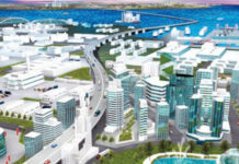
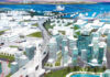
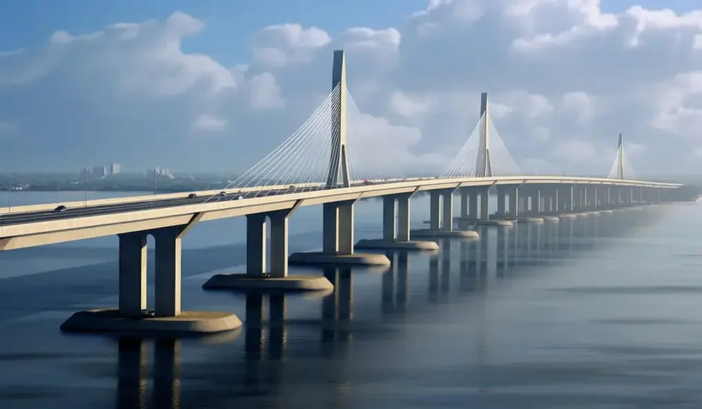
The proposed Mombasa Gate Bridge is the solution that has emerged from more than a decade of feasibility studies, environmental assessment and detailed engineering. It is designed as a major cable-stayed crossing between Mombasa Island and the South Coast, with a 660-metre main span and a bridge and road system extending for more than 13 kilometres when its principal approach structures and road works are taken together.
The project is now approaching the point at which the design will be translated into construction. In August 2026, the Kenya National Highways Authority (KeNHA) concluded an Independent Design Verification process involving the project design and verification teams, JICA and other stakeholders, clearing an important technical stage before tendering.
A bridge constrained by a working harbour
The fundamental engineering problem begins with geography.
Mombasa Island is separated from the South Coast by the Likoni Channel, a marine corridor that forms part of the wider approach to Kilindini Harbour. The channel is more than simply a gap between two pieces of land. Ships must continue to enter and leave the port beneath the proposed crossing, while the bridge itself must carry four lanes of road traffic above the water.
The original project studies therefore treated navigation clearance as one of the principal design constraints. The selected bridge arrangement provides a 660-metre centre span, with a vertical navigation clearance of 69 metres above the highest water level and approximately 600 metres of lateral navigation clearance between the principal bridge piers.
That requirement has major consequences for the structure.
A conventional short-span bridge with numerous piers distributed across the channel would interfere with maritime operations and expose more of the structure to ship impact and marine construction risks. The design instead concentrates the principal crossing into a long cable-stayed span, allowing the navigation channel to remain substantially open beneath the bridge.
The bridge is therefore not simply a long road deck suspended above the water. Its geometry is a direct response to the competing requirements of road transport and maritime navigation.
The cable-stayed solution
The main bridge is designed as a 1,320-metre hybrid composite cable-stayed structure arranged around a 660-metre central span. The earlier engineering configuration comprises three principal spans of approximately 330 metres, 660 metres and 330 metres, supported by four principal piers. The detailed-design consortium subsequently describes the main crossing as a hybrid composite cable-stayed bridge with a 660-metre centre span.
The choice of a cable-stayed bridge is particularly suited to the problem because it allows a long crossing without requiring the very large structural depth or the number of waterborne supports that a conventional girder bridge of equivalent length could require.
The cables transfer loads from the deck into the towers and down into the foundations. This creates a structural system in which the deck, stay cables, towers and foundations work together rather than behaving as independent components.
The 660-metre centre span is the defining element. The main piers are positioned toward the shorelines rather than placing supports in the middle of the principal navigation corridor. Earlier project documentation placed the main piers on the shallow-water areas on either side of the channel, allowing the central navigation space to remain substantially unobstructed.
The bridge deck is designed to carry four traffic lanes, with a pedestrian passage incorporated into the crossing. The wider project, however, is much more than the 1.32-kilometre cable-stayed structure itself.
A 13-kilometre-plus transport system
One of the easily overlooked aspects of the Mombasa Gate Bridge project is that the headline bridge represents only one part of the engineering works.
The detailed design developed by the Japanese consortium comprises a 1,320-metre main bridge, approximately 2,142 metres of approach bridges, 1,340 metres of ramp bridges, 4,671 metres of approach roads and 4,163 metres of street upgrades. The project also includes tolling and operations facilities, a management office, a weigh station and intelligent transport-system facilities.
The approach structures use several different structural systems rather than simply extending the cable-stayed bridge to the shore.
The detailed design specifies steel box girders, prestressed-concrete box girders, prestressed-concrete ribbed decks and prestressed-concrete U-girders for different sections of the approach and ramp structures. This allows the structural solution to change according to span, terrain, road geometry and the constraints imposed by the existing urban environment.
On the Mombasa Island side, the alignment was developed to integrate with the existing road network rather than simply terminating at the ferry approach.
The earlier project studies envisaged the elevated route beginning around Lumumba Road, passing through the urban road system and incorporating interchanges serving roads including Moi Avenue and Archbishop Makarios Road before reaching the crossing. On the South Coast side, the bridge continues through Likoni and connects to the road network leading toward the Mombasa Southern Bypass.
This is an important engineering distinction. The project is intended to replace a bottleneck with a continuous transport corridor, not merely replace a ferry with a bridge.
Keeping ships moving beneath the bridge
The most demanding feature of the crossing is arguably the requirement to maintain maritime access while construction takes place.
The Likoni Channel is part of a port environment, meaning the construction methodology has to account for vessels, navigation restrictions and the consequences of temporarily reducing the available channel width.
Project consultations documented discussions with the Kenya Ports Authority over construction of the centre span and the temporary management of navigation. The design also incorporates protection around the principal marine piers against vessel collision. A ship-collision protection structure is provided around the offshore main pier.
The result is a bridge that must be designed not merely for its permanent loading but for the unusual temporary conditions created during construction.
Building a conventional bridge across a quiet river allows relatively straightforward access to the work area. Building across a commercially important harbour channel introduces another layer of engineering coordination: marine plant, navigation controls, temporary works, construction sequencing and restrictions on when and where equipment can operate.
KeNHA’s later independent verification requirements specifically include review of the proposed construction sequence and programme, together with bathymetric surveys, geotechnical information, structural calculations, wind-tunnel results and other design inputs.
Foundations in a marine environment
The bridge’s long spans do not eliminate the foundation challenge; they concentrate it.
The principal bridge supports have to transfer substantial vertical, horizontal and dynamic loads into the ground while operating in a marine environment. They must also withstand the effects associated with vessel impact, wind, seismic loading and long-term deterioration.
Japanese project documentation has previously identified the use of Japanese steel pipe-sheet-pile foundation technology as one of the technologies intended for the project.
The final detailed design involved extensive investigations before the structure could be taken to tender. The independent verification requirements identify geotechnical factual and interpretive reports, topographical and bathymetric surveys, structural design documentation and wind-tunnel test results among the material to be independently examined.
That verification process matters particularly for a cable-stayed bridge of this scale. The structural response is affected by the interaction between the deck, towers, cables and foundations, while wind can produce significant aerodynamic effects on a long, slender bridge.
KeNHA’s procurement documents state that the intended bridge design and construction specification must achieve international best practice in safety and service performance and support a 120-year service life.
Designing for wind, earthquakes and a 120-year life
The coastal location introduces a combination of environmental demands that cannot be treated separately.
Mombasa’s hot, humid and saline environment creates an aggressive exposure condition for steel and reinforced concrete. Corrosion protection therefore becomes a life-cycle engineering issue rather than merely a construction-quality concern.
At the same time, the long cable-stayed deck must be checked for aerodynamic behaviour. Wind-tunnel testing is explicitly included among the technical documents subject to independent verification.
The structural system must also account for seismic effects. The detailed-design process included natural-condition surveys covering seismic and wind conditions, together with topographic and geotechnical investigations.
These considerations help explain why the project has required a lengthy design process before construction.
The bridge is not being treated as a simple road project. Its design involves structural engineering, geotechnical engineering, marine engineering, highway design, traffic engineering, environmental management, navigation requirements and urban road integration.
The alignment is itself an engineering solution
Another significant decision was where to put the bridge.
The most obvious alignment would have been a direct crossing at the existing Likoni Ferry terminal. The project studies instead developed an alignment that avoids some of the most sensitive constraints around the ferry crossing and connects into a wider road system.
The selected route begins on Mombasa Island, crosses the urban area, passes over the channel and lands in the Likoni area before continuing towards the Southern Bypass. The earlier environmental assessment records that alternative alignments were evaluated against issues including Mama Ngina Park, military installations, environmental effects and the ability to integrate the bridge into the wider Mombasa road network.
This is why the project should not be viewed just as a bridge between two points on opposite sides of the water. The alignment is effectively an urban transport intervention wrapped around a major marine crossing.
BIM and detailed engineering
The detailed engineering phase was carried out by a Japanese consortium led by Nippon Koei and involving Katahira & Engineers International, Nippon Engineering Consultants, Chodai and Hanshin Expressway.
Katahira’s project record identifies the detailed-design period as February 2020 to March 2023 and lists BIM/CIM and detailed design among the principal services.
The use of BIM/CIM is particularly relevant to a project containing multiple bridge types, interchanges, existing roads, utilities, marine constraints and extensive approach works.
A digital model allows the various disciplines to coordinate geometry and interfaces before construction. For a project that passes through a dense urban environment and transitions between elevated structures, marine structures and conventional highway sections, this coordination can be as important as the structural calculations themselves.
The design-verification process subsequently provided another technical layer between design completion and construction procurement.
KeNHA’s independent verification terms required an independent analysis of the design rather than simply accepting the original designer’s calculations. The verification covers bridge planning, structural designs and drawings, geotechnical information, wind-tunnel results, construction sequencing, local constraints, bathymetric surveys and tender documentation.
Who is delivering the project?
The Kenya National Highways Authority is the implementing agency responsible for delivery of the Mombasa Gate Bridge Construction Project, working with the Government of Japan and JICA.
The detailed design was undertaken by a Japanese consortium comprising Nippon Koei Co. Ltd, Katahira & Engineers International, Nippon Engineering Consultants Co. Ltd, Chodai Co. Ltd and Hanshin Expressway Co. Ltd.
The consultancy for tender assistance and construction supervision was awarded to a joint venture led by Nippon Koei together with Katahira & Engineers International, Nippon Engineering Consultants and Hanshin Expressway, with Koei Africa, BAC Engineering & Architecture and Uniconsult Engineering Consultants as sub-consultants.
There is an important distinction at the current stage, however. A main works construction contractor has not yet been appointed.
As of August 2026, KeNHA had just concluded the Independent Design Verification and was preparing to proceed toward tendering. Reports of the August technical meeting identify Nippon Koei, Arup-AMA and JICA among the project partners involved in the verification process, but these are consultants and project partners, not the contractor that will ultimately build the bridge.
The identity of the construction contractor should therefore be treated as an outstanding procurement matter rather than stated prematurely.
The cost has changed substantially since the original loan
The project’s financing history illustrates another challenge.
The original loan agreement signed between Kenya and JICA in December 2019 was for ¥47.8 billion. National Treasury debt records break this into principal components of ¥45.083 billion and ¥2.717 billion.
That figure is no longer the same as the project’s current estimated overall cost.
Following completion of the detailed design, the Government reported to Parliament in 2024 that the project had been appraised at approximately ¥284.4 billion. Of this, ¥194.532 billion was classified as eligible project expenditure and ¥89.843 billion as counterpart funding.
The Government consequently sought an increase in JICA’s eligible financing from the original ¥120 billion provision referenced in the parliamentary response to ¥194.532 billion, alongside additional Kenyan counterpart funding.
The Kenyan counterpart component includes land acquisition and compensation, administration, taxes and duties. The Government reported that National Treasury had committed funding, while approximately KSh19.4 billion was identified at the time as immediately required for land acquisition and relocation of utilities.
The project is now commonly reported at approximately KSh85 billion, although the underlying financing documentation is denominated primarily in Japanese yen and the precise shilling equivalent will vary with exchange rates and the treatment of the different financing components. The important point is that the present project cost is substantially higher than the original 2019 financing envelope.
Land acquisition has been one of the prerequisites
Before a project of this scale can move from design into physical construction, the road reserve and associated land must be secured.
The National Land Commission has been involved in acquiring land required for the project, with notices issued for parcels along the bridge and approach corridor. Land acquisition has included compensation for affected property owners and has been identified by the Government as a prerequisite to commencement of works.
The issue has also generated legal disputes. In one case, the Environment and Land Court found that property had been accessed for the project without the required compensation being paid, underscoring the practical difficulty of assembling the right of way for a major transport corridor through an already developed urban area.
These are not peripheral issues to the engineering programme. A bridge can be fully designed but cannot proceed into construction if the contractor cannot obtain unrestricted access to the work fronts.
From design to construction
The next engineering challenge is therefore no longer deciding whether a bridge can cross the Likoni Channel. The principal structural solution has been developed.
The challenge is now turning that design into a constructible sequence while maintaining the operation of Mombasa’s road and port systems.
The completed design has to be converted into tender documents, construction packages and a detailed programme. Once a contractor is appointed, the project will have to establish access and temporary works, undertake foundation construction, erect the major bridge supports, construct the approach structures and progressively assemble the cable-stayed crossing.
The centre span presents the most distinctive construction challenge.
Because the navigation channel cannot simply be treated as a conventional construction site, erection of the long span will require carefully controlled temporary conditions and coordination with maritime authorities. The construction sequence must preserve the required permanent geometry while managing temporary reductions or restrictions in navigable space.
The independent verification process specifically requires scrutiny of construction sequencing and the construction programme, reflecting the fact that the “how” of building the bridge is inseparable from the structural design itself.
What the bridge changes
When completed, the Mombasa Gate Bridge will provide a permanent road connection between Mombasa Island and the South Coast, removing the need for the principal road movement between the two areas to depend on the Likoni Ferry.
Its significance extends beyond replacing the ferry.
The bridge will create a continuous road connection from Mombasa Island through Likoni and onward to the Southern Bypass, linking the island’s urban and port economy more directly with the South Coast transport network.
It will also separate road movement from ferry operations. Traffic will no longer have to be loaded onto vessels before continuing its journey, while the port’s marine traffic will continue beneath the bridge.
The engineering challenge is what makes the project significant.
Mombasa Gate Bridge has to carry a four-lane highway across a major marine channel, maintain clearance for large ships, withstand wind and seismic forces, protect its marine supports against vessel impact, integrate with an existing urban road system and survive a corrosive coastal environment over a design life of 120 years.
The solution is a hybrid composite cable-stayed bridge centred on a 660-metre main span, supported by a much larger network of approach bridges, ramps, interchanges and roads.
After years of feasibility studies, land acquisition, financing negotiations and detailed design, the project is now approaching the point where those engineering drawings will have to become physical infrastructure.
The next milestone will therefore be the procurement and appointment of the main works contractor — and, ultimately, the first foundations of a bridge intended to permanently change how Mombasa Island connects with Kenya’s South Coast.

-
Product on sale
 AWEBook Volume 2Original price was: KShs 3,500.00.KShs 3,000.00Current price is: KShs 3,000.00.